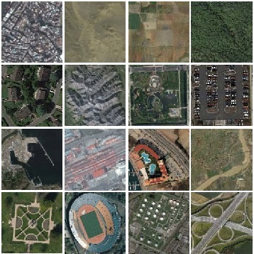
This multi-sensor dataset [1] was acquired over different cities of KSA (i.e., Riyadh, Al-Qassim, Al-Rajhi farms, Al-Hufuf and Jeddah) by three different VHR sensors including IKONOS-2, GeoEye-1 and WorldView-2 with spatial resolutions of 1 m, 0.5 m and 0.5 m, respectively. This dataset consists of 3250 RGB images of size 256×256 pixels categorized into 13 classes (250 images per class). The class labels are as follows: agriculture, beach, cargo, chaparral, dense residential, dens trees, desert, freeway, medium-density residential, parking lot, sparse residential, storage tanks, and water.
[1] Othman, Y. Bazi, F. Melgani, H. Alhichri, N. Alajlan, and M. Zuair, “Domain Adaptation Network for Cross-Scene Classification,” IEEE Transactions on Geoscience and Remote Sensing, vol. 55, no. 8, pp. 4441–4456, Aug. 2017, doi: 10.1109/TGRS.2017.2692281.

 Alhichri Inc.